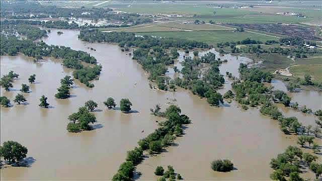
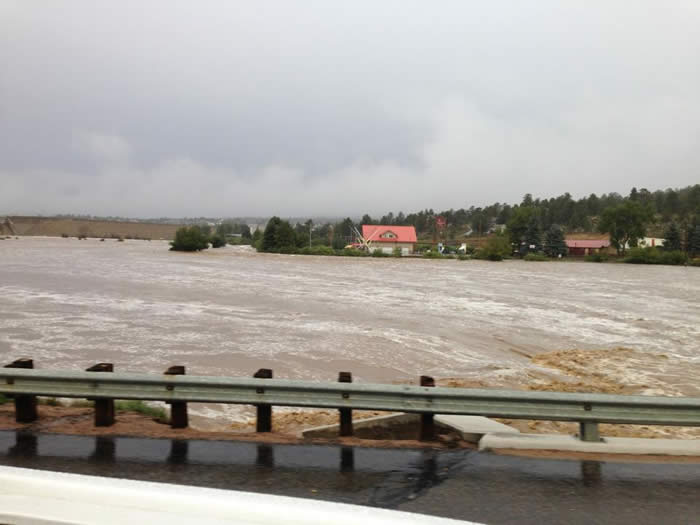
Redgate Farm was inundated by flood water in September of 2013 This page is now under construction... The rain started falling on September 13th,2013. In the next 48 hours a total of 18 inches of rain fell in the mountains and across the front range. An additional 6 inches fell two days later. There are four rivers, the St Vrain River join together and collect all of the rainfall. The South Platte and the Big Thompson joins the Cache La Poudre to the west of Redgate Farm. The South Platte is the southern border of the farm. The Cache La Poudre joins the South Platte on the south west corner of the farm. With the torrential downpours that finally left 22 inches of rain total. The location of the Farm and surrounding communities made it the perfect storm for disaster. No one would have believed what would happen in the next several days waiting for the water to come. When it finally arrived it sent the South Platte River 19 feet over flood stage.
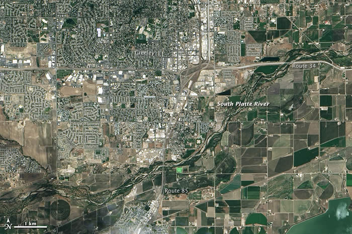
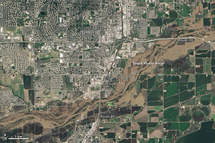
Above: The 3 White buildings in the right upper corner edge are the House, Garage and Barn here at Redgate. I'm happy to report that even though the flood waters came to within 50 feet of the house. The rest of the farm is under water but other than fences. We are safe. The house is standing and the flood waters are receding. Thanks to NASA and Big Brother... Here are survelance photos taken from space. Creepy and Interesting all at the same time.
Normally, a very dry state, Colorado get 11 inches of rain a year...
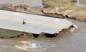
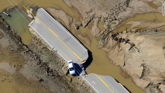
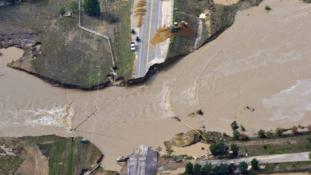
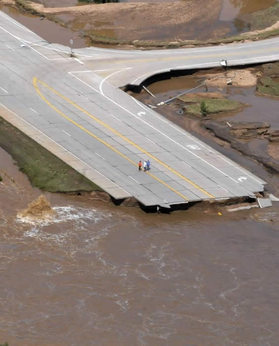
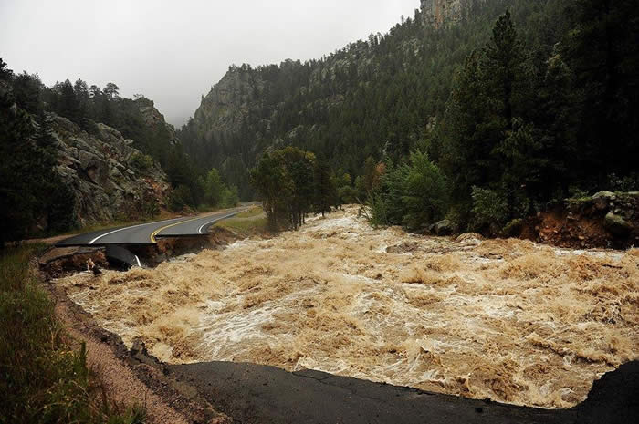
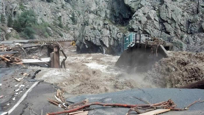
Most of the bridges that take us to surrounding towns are destroyed.
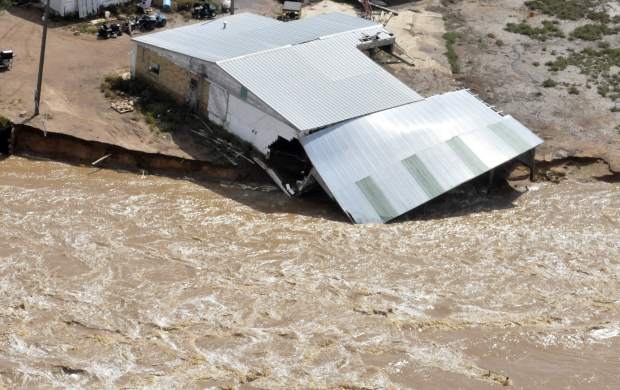
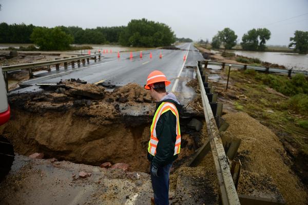
The destruction is truely unbelievable. Hundreds of miles of Roads, 30 Major Bridges, Homes and Barns swept down river... I'm not quite sure how we made it through. Other than flooding the horse barns and needing to dry out we were truely blessed.
The only thing left on the road to Kersey is the right shoulder.
State Hwy 34 at 18th Street. x
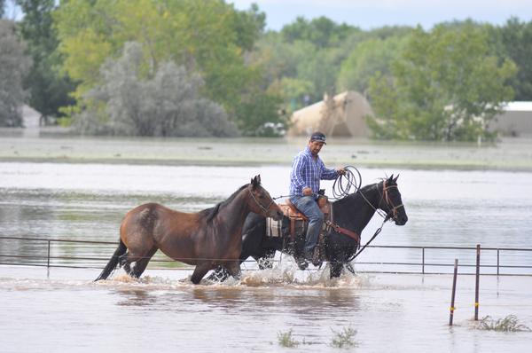
One of our neighbors rides his horses to safety. Two of our horses were evacuated to a Quarter Horse Farm north of our farm. No one would take our Stallion, Omen. He had to ride it out in a coral on high ground. He is fine... Then just when you thought things couldn't get hectic enough. Monday ~ September 16th, 2013...Wow decided to have puppies. Sadly, we lost 3 of the 6 pups but we are so happy to report Wow and babies are doing fine...
Ready to pack it in and make a run for it. Now the final component. Waiting for the last 6 inch downpour to move down from the mountains.
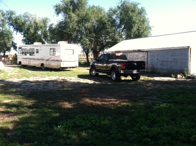
Darrell had the RV out and ready to load up the dogs and make a run for it after the Sheriff Deputys came and said an additional Levy had breached and he advised him to leave.
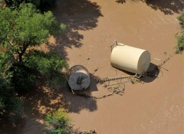
On top of the environmental concerns today they said 10 oil tanks are leaking oil into the St Vrain and South Platte rivers. The St Vrain joins the South Platte River to the southwest of Redgate. So in addition to the dead animal, gasoline from drowned vehicles, garbage, sewage from the Evans Water Treatment Plant that was topped over there is no end in sight as to when things will get back to normal.
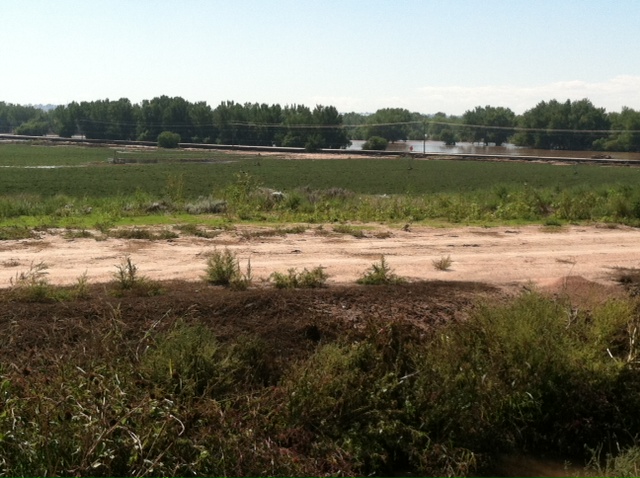
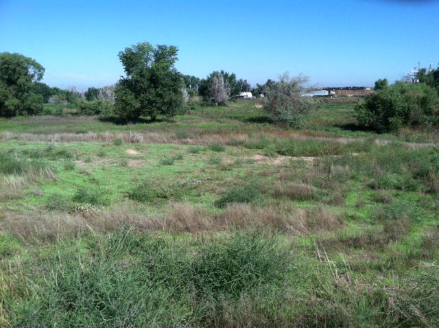
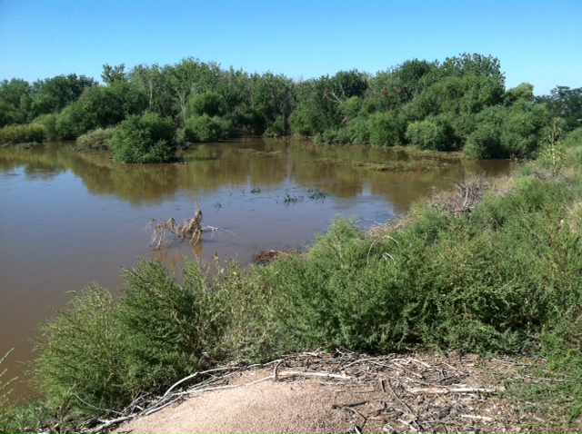
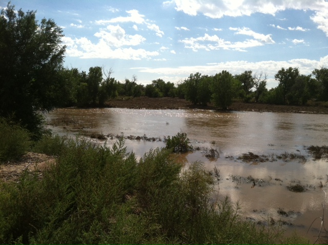
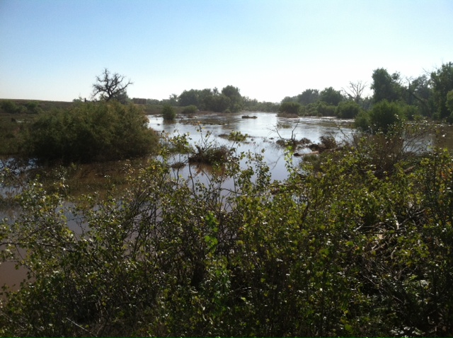
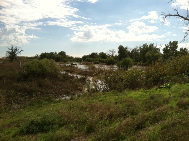
This picture was taken on highest part of the farm a hill about half way back on the property. It's about a quarter mile from the house. This is the view from the hill looking back toward the house, barns and road. This was all under water. Click here to go to YouTube video. Below is the view from the top of the hill looking south on September 18th, 2013
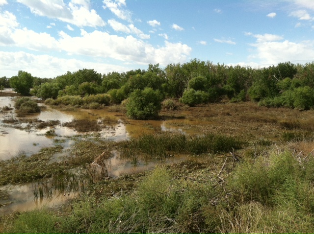
Above the view on September 19th, 2013. The flood water is receding and heading east. This morning they say the surge is moving through Ogallala Nebraska.
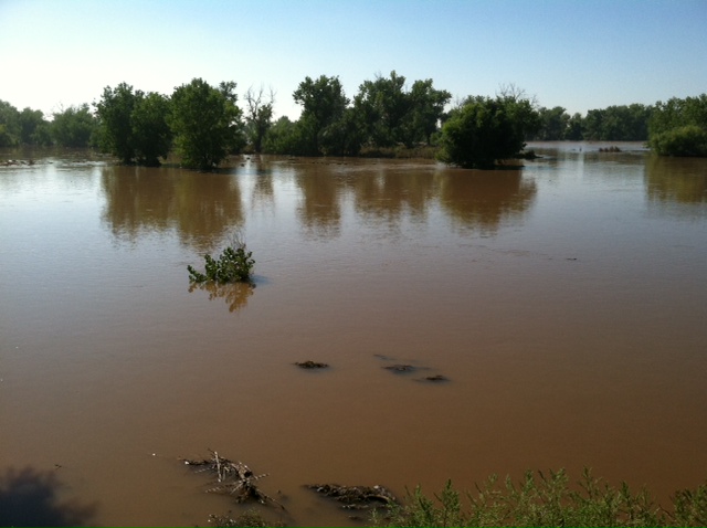
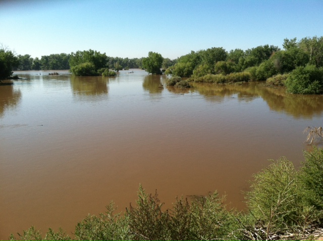
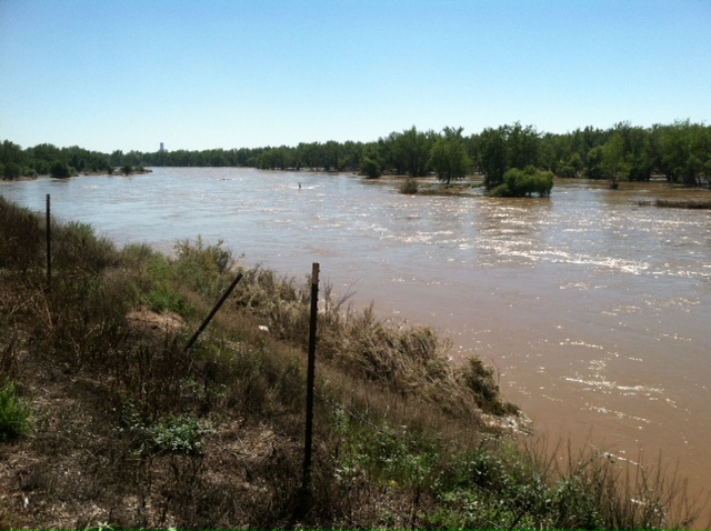
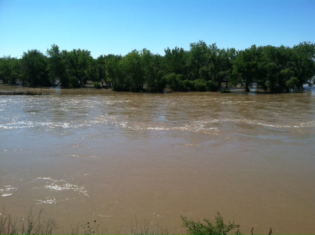
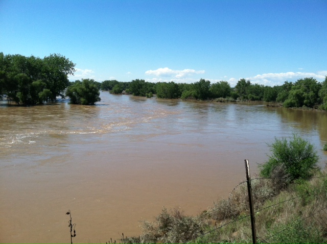
Below: The view from a high point above the South Platte River Bend. Normally, about 100 feet wide it is about a 1/2 mile in these pictures.
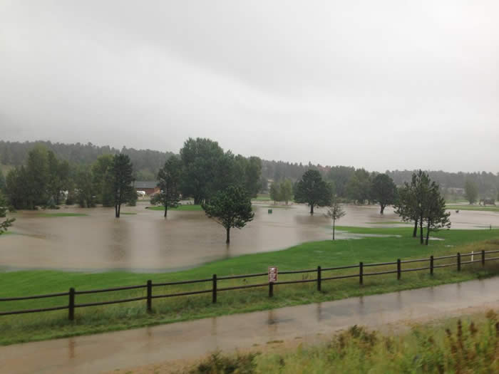
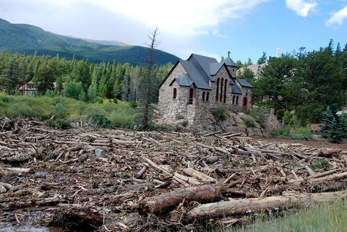
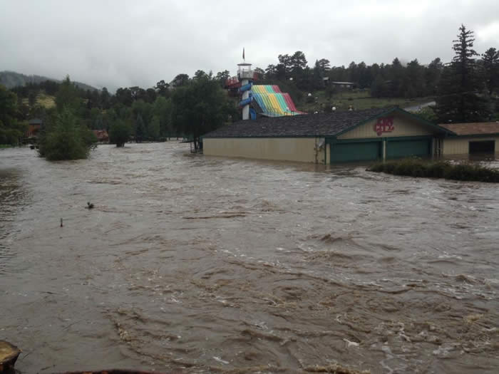
Here are some pictures of Estes Park and the Canyons.
The Estes Park Golf Course
Saint Malo's
My heart nearly stopped when I saw this. Is Sweet Basilico gone??? It's my favorite place to eat!
The area by the Ride a Kart.
Highway 7 is destroyed.
The Narrows at the bottom of the Big Thompson Canyon... By the Dam Store.
The Narrows at the Pipe.
|